NORTH QUEENSLAND'S NEW ANCHORAGE ENCYCLOPAEDIA
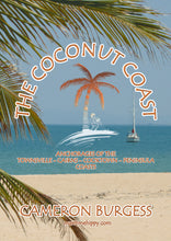
The Coconut Coast: Anchorages of the Townsville, Cairns, Cooktown and Peninsula Coasts.
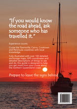
"If you would know the road ahead, ask someone who has travelled it."
Experience counts.
Cruise the Townsville, Cairns, Cooktown and Peninsula coastlines with local knowledge.
Fully illustrated with over 100 detailed anchorage maps, GPS coordinates and detailed descriptions of things to see and do, this guide is designed to help you get more from your cruise along the northern Queensland coast from Gloucester Island to Princess Charlotte Bay.
Prepare to leave the signs behind ...
- Over 160 pages packed with contemporary information for each of these locations: Acheron Island, Arthur Bay, Balding Bay, Bathurst Head, Bedarra Island, Bluff Creek, Bodg-Joo Island, Bolger Bay, Bona Bay, Bowen Harbour, Breakfast Bay, Bridge Creek, Cape Bedford, Cape Cleveland Lighthouse, Cape Flattery, Cape Kimberley, Cape Melville, Cape Richards, Cape Tribulation, Cape Upstart, Cardwell, Casement Bay, Clump Point, Cooktown, Endeavour River, Coombe Island, Coral Creek, Creek Number 6, Curacoa Island, Davies Reef, Deluge Inlet, Dicksons Inlet, Double Island, Townsville, Dunk Island, East Hope Island, Fitzroy Island, Florence Bay, Fly Island, Four Mile Creek, Frederick Point, Gayundah Creek, Goold Island, Green Island, Greys Bay, Harrier Point, Havannah Island, Haycock Island, Hazard Bay, Herald Island Spit, High Island, Hillock Point, Horseshoe Bay, Howick Island, Hudson Island, Huntingfield Bay, Ingram Island, Innisfail, Johnstone River, John Brewer Reef, Johnstone River, Juno Bay, Keeper Reef, Kent Island, Kings Beach, Little Fitzroy Island, Little Pioneer Bay, Little Ramsay Bay, Lizard Island, Lodestone Reef, Long Beach, Low Isles, Macushla Cove, Martin Bluff, Mermaid Cove, Michaelmas Cay, Mission Bay, Montes Reef Resort, Mourilyan Harbour Swing Basin, Ninian Bay, Normanby Island, Norris Bay, North Brook Island, North East Bay, Onion Bay, Orchid Beach, Owen Spit, Paluma Creek, Passage Islet, Pelorus Island, Picnic Bay, Pioneer Bay, Port Douglas, Queens Bay, Radical Bay, Rattlesnake Island, Ribbon Reef Number 10, Rocky Bay, Russell Island, Scraggy Point, Shark Bay, Shepherd Bay, Smith's Creek, Snapper Island, Southern Beach, Squally Bay, Stokes Bay, Stone Island, Sugar Wharf, The Cod Hole, The Spit, Trinity Inlet, Turtle Bay, Upolu Cay, Vlasoff Cay, Wallaby Point, Watsons Bay, Wheeler Island, Wheeler Reef, White Lady Bay, Wongaling Beach, Yanks Jetty, Zoe Bay
- Each hand-drawn map uses standard colors and textures throughout and has been decluttered to aid in your rapid situational awareness. Key maps for coastal sections give you a clear understanding of what options are around you. Always reference all maps in this guide against your official hydrograpic charts
- GPS coordinates of suggested anchorages.
- Windroses for each location help you decide if this spot is right for you in your current weather conditions.
- The extensive planning section covers communications, fuel, fresh water, your health and wildlife you'll meet along the way.
- Detailed notes, history, walks, and other points of interest on each anchorage, making sure you don't miss a thing while you are there.
Softcover
Author: Cameron Burgess also wrote Townsville to TI (Thursday Island) 2019


